A massive £6m surface dressing scheme is about to happen right across Lincolnshire this summer.
The huge set of works is the biggest ever and will really make a difference across 177 miles of our county’s roads.
Summer holidays. A time to relax, take stock, rest up. But not if you’re in the road resurfacing game in Lincolnshire. That’s because a huge-scale surface dressing scheme is about to get underway across a staggering 227 sites using 26,000 tonnes of material and thousands of work hours. To give you some idea of how much bigger that is than what went before, last year’s summer scheme covered 150 sites. 2024 is getting 77 more sites resurfaced than 2023’s tally.
Due to begin on Monday, July 8, it’ll take seven weeks to see the summer dressing scheme completed and there’s a high chance it will happen close to you. As something to put in place to help improve the condition of roads, this type of topping really works and, with money so very tight in all quarters of spending across the board, it’s comparatively affordable, quick to do - and will put another ten years on a road’s life.
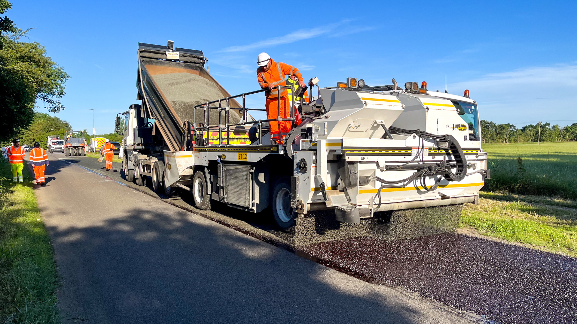
So, what exactly is ‘surface dressing’. Well, you’ll know it as those small stone chips that are put down on the road which mean a drop in the speed limit for a few days. But what using these stones and tar does do is make struggling roads better to drive on. It makes the road more level and, once the stones are bedded in, is virtually identical to other road surface types.
LCC Highways crews are about to get rolling with this £6 million surface dressing project which will run through to the end of August (ish) - it’s worth noting that the end date of August 31 may get a tad extended if the summer eventually turns a bit soggy, or gets extremely hot again. You can’t lay stones on top of a surface that is literally melting underfoot, after all.
So. It’s £6 million being spent. At 227 sites. In around 54 days, if it all goes to plan. On top of that (as if that’s not enough to be going on with) LCC has come up with a scheme that will use 10,000 tonnes of recycled material to really lessen environmental impact. Basically, the recycled material comes from sweepings of loose material that come from last season’s works. Re-do, re-use and re-lay. Simple stuff that continues to make a massive difference overall to road users.
In total, there’s 177 miles of Lincs roads getting the stone chip makeover – and that's enough to cover a road running from Lincoln to Bristol.
Cllr Richard Davies, executive member for Highways said: “Surface dressing is a great way to improve the road surface and give it another decade of life at a fraction of the cost of having to dig up the road and re-lay it.
“The reality is that it costs about a tenth of other techniques, and it’s much quicker to get in place, too. Out expert crews can put down around 30,000 square metres of surface – about the same as 154 Wimbledon tennis courts.
“On top of that, we don’t always need a full road closure to do surface dressing which, naturally, really helps to cut down on traffic flow disruption.
“It all means that surface dressing is a really valuable addition to the methods we use to keep the roads in shape, and to bring improvements to the county.
“We have never carried out a surface dressing scheme of this scale before and really shows our continuing commitment to the huge amount of positive work we are getting on with for Lincolnshire road users.”
See a list of the hundreds of schemes happening across Lincolnshire here.
Don't become prey to scammers posing as us while the works are happening, learn more about tactics scammers may use here.
Here’s a list of all the roads that are getting a surface dressing treatment this summer:
- Addlethorpe Bypass, Addlethorpe
- Pilham Lane, Aisby
- Goltho Road, Apley
- Howell Fen Drove, Asgarby
- Millthorpe Lane, Aslackby
- A607 Grantham Road, Belton
- Main Road, Benniworth
- Meadow View, Benniworth
- Folkingham Road, Billingborough
- A52 Sleaford Road, Boston
- Sheriff Way, Boston
- Robin Hoods Walk, Boston
- Marian Road, Boston
- Sherwood Ave, Boston
- Ashlawn Drive, Boston
- Station Approch / Station Street / Lincoln Lane, Boston
- Fernleigh Way, Boston
- Princess Anne Road, Boston
- Queens Road, Bourne
- Charles Close, Bourne
- Ancaster Road, Bourne
- Stanley Street, Bourne
- Dyke Drove, Bourne
- North Causeway / Delph Road. Branston Booths
- Lincoln Road, Brant Broughton
- Mill Lane, Brant Broughton
- A46 Grimsby Road, Cabourne
- Rawlinson Avenue, Caistor
- Risedale, Caistor
- Westwold Road, Caistor
- B6403 High Dyke, Caythorpe
- A52 Chapel Road, Chapel St Leonards
- Rose Cottage Lane, Coleby
- A151 Bourne Road, Colsterworth
- A151 (A1 Flyover), Colsterworth
- Dogdyke Road, Coningsby
- Ings Lane, Covenham
- Martins Road, Crowland
- Peterborough Road, Crowland
- A16 Cowbit / Crowland Bypass, Crowland
- Main Street, Denton
- Dunsby Drove, Dunsby
- Marden Hill, East Keal
- Gaysfield Road / Cut End Road. Fishtoft
- Church Green Road, Fishtoft
- Priory Road, Fishtoft
- Eastgate / Hall Gate / Church Gate / Proudfoot Lane / Bens Gate Road, Fleet Hargate
- A15 Mareham Lane, Folkingham To Aslackby
- Chapel Lane, Foston
- A16 Fotherby Bypass, Fotherby
- North Elkington Lane, Fotherby
- Thornimans Lane, Frampton
- Church View / Shore Road, Freiston
- Cranberry Lane, Friskney
- Dawsmere Road / Church Street / Marsh Road / Guys Head Road / West Bank Road / New Road, Gedney Drove End
- B1359 Marsh Road, Gedney Dyke
- Dawsmere Road / Sots Hole Bank Road, Gedney Marsh
- Chopdike Drove, Gosberton Clough
- Sandon Close, Grantham
- The Knoll, Grantham
- Hatcliffe Close, Grantham
- Ravendale Close, Great Gonerby
- B1394 Heckington Road, Great Hale
- A158 Gunby Dual Westbound, Gunby
- Cliff Road, Hackthorn
- A155 Hagnaby, Hagnaby
- A157 Lincoln Road, Hainton
- Rimes Lane, Haltham
- The Drift, Harlaxton / Barrowby
- Kyme Road, Heckington
- Vicarage Lane, Helpringham
- Chapel Lane, Helpringham
- School Lane, Helpringham
- Hemswell Lane / Church Lane, Hemswell
- Park Lane, Holbeach
- Edinburgh Walk, Holbeach
- The Hollies, Holbeach
- Chestnut Avenue, Holbeach
- Lime Grove, Holbeach
- Silver Street, Holton Le Clay
- A46 Holton Road, Holton Le Moor
- A52 Holland Road, Horbling / Swaton
- A158 Jubilee Way, Horncastle
- Ingham Lane, Ingham
- Anchor Lane, Ingoldmells
- A157 Louth Road, Legbourne
- A46 Lincoln Bypass (Westbound), Lincoln
- A57 Saxilby Road, Lincoln
- Old Pond Close, Lincoln
- Rivermead, Lincoln
- Fen Road. Little Hale
- B1394 Main Road, Little Hale
- Alvingham Road, Louth
- A16 Louth Bypass, Louth
- Alexander Drive, Louth
- Burton Court, Louth
- Queens Court, Louth
- Quorn Gardens, Louth
- Stewton Lane, Louth
- A631 Caistor Road, Market Rasen
- Martin North Drove, Martin
- Daws Gate, Moulton
- Red Cow Drove, Moulton Marsh
- Washdyke Lane, Nettleham
- Newstead Lane, Newstead
- Mill Lane, Newstead
- Fleetway, North Cotes
- A1434 Newark Road, North Hykeham
- Gulham Road, North Owersby
- Eagle Road, North Scarle
- Spalford Road, North Scarle
- Chapel Lane / Swinderby Road, North Scarle
- Spalford Road, North Scarle
- A16 Main Road, North Thoresby
- A16 North Thoresby, North Thoresby To Waithe
- A631 Willingham Hill, North Willingham
- A15 London Road, Osbournby
- High Street, Osbournby
- North Street, Osbournby
- Highfield Close, Osbournby
- Benniworth Road, Panton
- B1356 Spalding Road, Pinchbeck
- B1356 Surfleet Road / Church Street, Pinchbeck
- Barff Road, Potterhanworth
- A16 Kenwick Bar, Raithby Cum Maltby
- Blackey Lane, Revesby
- Aswardby Road, Sausthorpe
- Kirton Road, Scotter
- Susworth Road, Scotter
- High Street / Scotter Road / Eastgate / Kirton Road, Scotter / Scotton
- Northorpe Road, Scotton / Northorpe
- A158 Thunkers Hollow, Scrafield
- Whattons Close, Sedgebrook
- Church Lane, Sedgebrook
- Abbey Lane, Sedgebrook
- Psalter Lane, Skendleby
- Fishtoft Road, Skirbeck / Fishtoft
- Mareham Lane, Sleaford
- Ancaster Drive, Sleaford
- Harvest Way, Sleaford
- Moor Lane, Sotby
- Main Road, Sotby
- Thornton Road, South Kelsey
- B1395 Wood Lane, South Kyme
- Horseshoe Road, Spalding
- Carrington Road, Spalding
- Woolram Wygate, Spalding
- A16 Main Road, Spilsby
- Hill Road, Springthorpe
- Kingthorpe Road, Stainfield
- Roman Bank, Stamford
- Surfleet Bank / Newland Road, Surfleet
- Woods Lane (The Drayton), Swineshead
- A16 London Road, Tathwell / Hallington
- Thorpe Road, Tattershall
- Sandy Lane, Tealby
- Holton Road, Tetney
- B1190 Main Road, Thimbleby
- B1225, Caistor High Street, Thoresway
- Thoresway Bridleway, Thoresway
- Thornton Road, Thornton Le Moor
- Spanby Lane, Threekingham
- Thorpe Tilney Drove, Timberland
- A16 Bluestone Heath Road, Ulceby
- Common Lane, Upton / Heapham
- B1178 Mere Road, Waddington
- B1189 High Street, Walcott
- Mill Lane, Welbourn
- B1196 - Alford Road, Well
- Ryland Road, Welton
- Cliff Road, Welton
- Eagle Drive, Welton
- Old Fendike Road, Weston Hills
- Chapel Hill, Whaplode Drove
- Broardgate, Whaplode Drove
- Back Bank, Whaplode Drove
- Cranesgate North, Whaplode St Catherine
- Templegarth, Willoughton